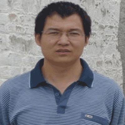
Dr. Shaohui  Chen
My Social Links

Dr. Shaohui Chen

Research Scientist
Chinese Academy of Sciences, China


Highest Degree
PostDoc Fellow in Data Assimilation and Fusion from Chinese Academy of Sciences, China

Share this Profile

Biography

Dr. Shaohui Chen is currently working as Associate Researcher, Institute of Geographic Sciences and Natural Resources Research (IGSNRR), Chinese Academy of Sciences (CAS), Beijing, China. He obtained his PhD in System Analysis and Integration from Huazhong University of Science and Technology, Wuhan City, Hubei Province, China. He has published total 50 papers, including (13) first-author SCI papers, (7) co-author SCI papers, (4) first-author EI papers, (5) co-author EI papers, (16) national citation index papers, 6 international meeting papers.
Area of Interest:

Earth Science and Geography
100%
Meteorology
62%
Remote Sensing
90%
Water Resource
75%
Geography
55%

Research Publications in Numbers

Books
0
Chapters
0
Articles
0
Abstracts
0

Selected Publications

  1. Chen, S., H. Su and J. Zhan, 2014. Estimating the impact of land use change on surface energy partition based on the Noah model. Front. Earth Sci., 8: 18-31.
    CrossRef  |  Direct Link  |  
  2. Chen, S. and H. Su, 2014. An eigenpoint based multiscale method for validating quantitative remote sensing products. Adv. Meteorol., Vol. 2014. 10.1155/2014/692313.
    CrossRef  |  Direct Link  |  
  3. Chen, S., J. Qi, X. Sun, X. Deng and J. Tian, 2013. An evapotranspiration assimilation method based on ensemble Kalman filter and a trous wavelet. Adv. Meteorol., Vol. 2013. 10.1155/2013/531810.
    CrossRef  |  Direct Link  |  
  4. Chen, S., H. Su, J. Tian and C. Zhan, 2013. Best tradeoff for remote sensing image fusion based on three-dimensional variation and a trous wavelet. J. Applied Remote Sens., Vol. 7. 10.1117/1.JRS.7.073491.
    CrossRef  |  Direct Link  |  
  5. Chen, S., H. Su, R. Zhang, J. Tian and J. Xia, 2012. Scaling between Landsat-7 and SAR images based on ensemble empirical mode decomposition. Int. J. Remote Sens., 33: 826-835.
    CrossRef  |  Direct Link  |  
  6. Chen, S.H., H.B. Su, J. Tian, R.H. Zhang and J. Xia, 2011. Estimating soil erosion using MODIS and TM images based on support vector machine and a trous wavelet. Int. J. Applied Earth Observ. Geoinform., 13: 626-635.
    CrossRef  |  Direct Link  |  
  7. Chen, S., R. Zhang, H. Su, J. Tian and J. Xia, 2010. SAR and multispectral image fusion using generalized IHS transform based on a trous wavelet and EMD decompositions. Sensors J., 10: 737-745.
    CrossRef  |  Direct Link  |  
  8. Chen, S., R. Zhang, H. Su, J. Tian and J. Xia, 2009. Scaling-up transformation of multisensor images with multiple resolutions. Sensors, 9: 1370-1381.
    CrossRef  |  Direct Link  |  
  9. Tian, J., R. Zhang, H. Su, X. Sun, S. Chen and J. Xia, 2008. An automatic instrument to study the spatial scaling behavior of emissivity. Sensors, 8: 800-816.
    Direct Link  |  
  10. Chen, S.H., H.B. Su, R.H. Zhang, J. Tian and L.H. Yang, 2008. Improving empirical mode decomposition using support vector machines for multifocus image fusion. Sensors J., 8: 2500-2508.
    Direct Link  |  
  11. Chen, S.H., B. Su and H. Zhang, 2008. Feature space and metric measures for fusing multisensor images. Int. J. Remote Sens., 29: 3257-3270.
    CrossRef  |  Direct Link  |  
  12. Chen, S., R. Zhang, H. Su, J. Tian and J. Xia, 2008. Introducing object reflectance property and sensor spectral response into empirical mode decomposition based MODIS and TM image fusion. Can. J. Remote Sens., 34: 585-595.
    CrossRef  |  Direct Link  |  
  13. Chen, S., H. Su, R. Zhang, J. Tian and L. Yang, 2008. The tradeoff analysis for remote sensing image fusion using expanded spectral angle mapper. Sensors, 8: 520-528.
    Direct Link  |  
  14. Zhang, Z., X. Xu and S. Chen, 2007. Design and implementation of webGIS about power distribution management system based on ArcIMS and ASP.NET. Comput. Digital Eng., 35: 136-140.
  15. Zeng, Z., S. Chen, C. Wang and T. Yan, 2007. Degenerative image fusion based on the mean square energy. Water Resour. Power, 25: 72-75.
    Direct Link  |  
  16. Yan, T., Z. Zeng, S. Chen and F. Li, 2007. A novel multilayer fire detection model based on MODIS data. Water Resour. Power, 25: 38-41.
    Direct Link  |  
  17. Huang, Y.Y., Z.Y. Zeng and S.H. Chen, 2007. Application of MODIS data in dynamic soil-water conservation of Hubei province. Yangtze River, 32: 85-87.
    Direct Link  |  
  18. Chen, S.H., H. Su, R. Zhang and T. Tian, 2007. Fusing remote sensing images using a trous wavelet transform and empirical mode decomposition. Patt. Recogn. Lett., 29: 330-342.
    CrossRef  |  
  19. Chen, S.H., Q.W. Zhang, C. Wang and J.Z. Zhou, 2006. MODIS and SPOT images fusion based on the intensity correlation moment. J. Remote Sens., 10: 90-96.
    Direct Link  |  
  20. Chen, S.H., Q.W. Zhang, C. Wang and J.Z. Zhou, 2006. Fusing MODIS and SPOT images based on self-adaptive weighting. J. Image Graphics, 11: 349-353.
    Direct Link  |  
  21. Chen, S.H., Z.Y. Zeng and C. Wang, 2005. MODIS and SPOT images fusion based on the intensity correlation moment. Adv. Syst. Sci. Applic., 5: 633-637.
  22. Chen, S., Z. Zeng, Q. Zhang, C. Wang and J. Zhou, 2005. [Multisensor image fusion based on the weight correlation moment]. Applic. Res. Comput., 12: 150-151, (In Chinese).
  23. Chen, S., Q. Zhang, C. Wang and J. Zhou, 2005. [Multiresolution image fusion based on the normalized square deviation model]. Comput. Eng. Applic., 3: 25-27, (In Chinese).
  24. Chen, S., Q. Zhang, C. Wang and J. Zhou, 2005. [Degenerative image fusion based on the normalized square deviation]. Comput. Eng., 31: 31-47, (In Chinese).
  25. Liu, J. and S. Chen, 2001. [The application of shallow seismic image technology to the detection of the quality of water concrete dam]. Earth Sci., 26: 42-45, (In Chinese).